Monday, May 21, 2012

CA hot springs, pre-Yosemite


Route so far.  Bishop is at the junction of US 395 and US 6.


We toured Bishop, CA, for a couple of days.
  We also soaked in Keough Hot Ditch three times.
One evening and two morning baths.
Beautiful views.


It is possible to squeeze between the granite
boulders and allow the 100 degree water to
 massage your shoulders--ahhh.


A morning soak with a view of the hot ditch.


We then drove 37 miles north on US 395
to Mammoth Lakes area.  There are several
hot springs in the area, so after lunch, we 
explored.


This is The Hot Tub with the eastern slope of the 
Sierra Nevada to enjoy during the soak.


A few miles on a gravel road leads us to Shepherd Hot Spring.
  Judy tests the water.  She is facing the Sierras and 
 Alkali Lake is behind her.


After Shepherd, we walked about a half mile
to visit The Crab Cooker.  The water comes out of the 
spring at about 170 degrees, but the tub water is
about 105.


Another view with Judy at the The Crab Cooker.


The only hot spring that the National Forest or the
BLM (Bureau of Land Management)
tells you about is Wild Willy's Hot Spring. 
We did not soak here. It is much too crowded.
We prefer to have the place to ourselves.


We will visit a few more hot springs in the morning.
We took a nice evening drive through Mammoth Lakes
and the surrounding area. 
This is Lake Mary at 8,890 ft.  


Good morning!  The tub at Alkali Lake Hot Springs
is in the process of re-construction.   :(


The Alkali Lake.


We did find Shepherd Hot Spring up, running,
and private.


Shepherd Hot Spring.


We also found Hilltop Hot Spring up and running.
In fact, we met one of the volunteers that 
cleans the tubs there.  He just finished, and we were
the first to enjoy the scenery with a soak.


The scenery and us.


Hot Creek.  It is no longer soakable because of the
injuries and deaths.  The water has been measured 
at 199 degrees.  We enjoyed the view!


In the evening we toured toward June Lake.
On the way was Obsidian Dome.
(volcanic glass)
We climbed around and found a piece for a souvenir. 


Dennis on the dome.


Arriving at the motorhome, we needed to view the
annular eclipse.  Here is the safe way.  There was
a group of folks viewing through a welder's
helmet near us.  They invited us to view too!
Thanks.  In Mammoth Lakes, CA we had about 
90% blockage of the sun.  We had very nice
and a little eerie (almost twilight) light for 20 minutes,
 then the brightness returned and the world
did not end.


Or did it.


We will soak one more time in the morning then
head to June Lake (20 miles) for a hike and
a good night's rest.


Great morning!
Here is the morning soak with the Sierra's and a 
hot air balloon to view.  Extra nice.


The plumbing from the Hilltop Hot Spring leading 
to the tub.


We drove to Oh! Ridge, a National Forest campground,
 got set up and rested before heading to 
our hike.  We took the Rush Creek Trail to a beautiful
waterfall.  Actually two falls.


Rush Creek Falls.  About a 5 hour round trip
hike for us.  Most hikers just passed us by.


We stopped often, drank water, and took lots of pictures.
We also did a little catching of our breath.
Ending elevation was about 8500 ft.


At an overlook of June Lake.


At our turn around point.  Judy is not really
in danger on that ledge.  I just tried to
make it look that way.  Notice the trees,
they grow, more or less, straight up.


Like this one, with Judy in the trunk.
We enjoyed the rest of the hike down,
and even saw a mule deer near the bottom.
Still, we were exhausted.

On to Yosemite National Park.


Thursday, May 17, 2012

Nevada

Route through Nevada.


When we told one of the rangers that this was our 360th
National Park visited and that we had missed it
many times because of its remoteness, he replied:  
"It's a great park for solitude."


Just getting settled in our campsite.
One of the best we've had.


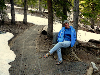
We took an evening stroll on a "Nature Trail" at the 
upper end of the road.  Around 10,000 ft. elevation.


Beauty, again, is everywhere.


The next morning we took a real hike.
Six hours of climbing, walking, and trudging  
through snow up to 11,000 ft.  From there we
were able to view the only glacier in NV.
It's a "rock glacier" meaning that it is 
covered in glacial rubble, so no pictures.


On the hike, goofing off.


A nearly dead bristlecone pine.  
On a recent post I said that these trees lived 
up to 2000 years!  Sorry,
they live up to 5000 years.  This one,
is 3200 years old (not Judy) as
determined by core samples.
The hole left by the bore fills with resin
within an hour and continues healing.


This tree is over 4000 years old and has been dead
several hundred years!  These guys do not rot, but 
weather, and may stand for a 1000 years after death.


A beautiful alpine lake and Judy.
10,200 ft.


Back at our campsite, exhausted.


Relaxing at our private mountain stream.


COOL.
Great Basin NP also has caves.  
Leaman Caves are some of the most
decorated on the country.
There were lots of damage and graffiti in places.
Mr. Leaman gave "tours" by showing you the entrance,
giving you a candle, and telling you that if
you weren't back in 24 hours, he'd come and find you.
His view of this asset wasn't exactly like the
National Park's:  "don't touch".  His was:
"If you can break it, you can take it."


The cave is still beautiful.  Here is the "Wedding 
Chapel".  Weddings were held here until the 1990's.


After our cave tour, we broke camp and drove 230 miles
to Tonopah, NV.  We parked the motorhome in a 
casino lot and drove the car to Akali Hot Springs.
(Look closely, Jan.)
We soaked and watched the sunset.


The hot springs.


The sunset.


As we were preparing to leave, a herd of wild
horses came galloping across the desert!
They were coming to drink at the overflow pond.


Beautiful, vibrant animals.


One more picture.
Good night Nevada.

On to California.


Sunday, May 13, 2012

Grand Staircase Escalante NM and Capitol Reef NP area

Route through Utah.

We are at the southern entrance of Capitol Reef NP,
at the western edge of the Waterpocket Fold.


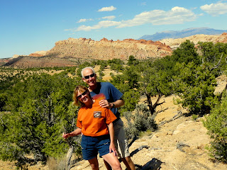
Enjoying the day.  You can see the eastern edge of the eroded fold.
The earth just folded without breaking about 275
million years ago.  The fold is a monocline and is 
about 100 miles long.  That is the geology--
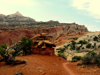
the scenery is even more remarkable.


If you work at i you can see the dirt road down the eroded 
fold.  It drops nearly 1000 ft in about 1 mile of switchbacks.


We are in the Grand Staircase Escalante NM.  
It is huge and great.  We spent several days exploring
the monument, which borders Bryce Canyon and 
Capitol Reef NP.   This is on the Burr Trail Rd.
It is said to be one of the best 30-mile drives
in the country.


A slot canyon dead end carved out of 
"rusted" sandstone.


Also in the slot canyon and in a water pocket.
When the sand dunes were buried and cementing materials
leeched through, some areas petrified harder 
than others.  Erosion wore away the pockets, 
making for interesting pictures..


At the entrance of the slot canyon.


More water pockets, this time in
Capitol Reef NP.


Sunset in Capitol Reef NP 
at Panorama Point.  We thought it was so
beautiful!  There are two more pictures following!


Told you.


Hiking to Cassidy Arch.  In the background is 
Fern's Nipple.  (Jan, I tried to get Judy's nipple
in the picture, but there was no hot springs around.)


Hiking to Cassidy Arch.


Almost there.


Hiking to Cassidy Arch.


Hiking to Cassidy Arch.

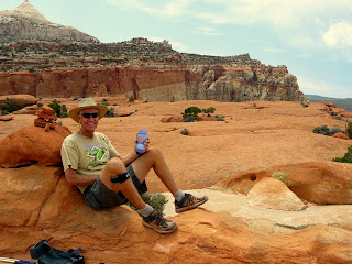
Finally there and celebrating with no pack and water.


The Cassidy Arch.


Judy, on the arch.


Our campsite in Capitol Reef NP.
It couldn't have been much better.


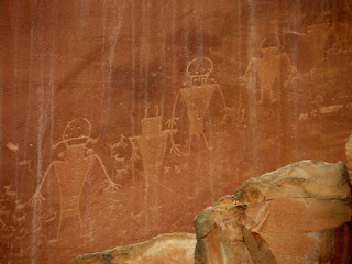
Fremont petroglyphs.  The Fremont people lived
in the same time frame as the Anasazi, but in this
area.  They disappeared around the same time but
left no clues to their next history.  Most think that the Anasazi
are the ancestors of the Puebloan societies.  


Beautiful golden Navajo Sandstone along 
UT 24 in Capitol Reef NP.
Judy too!


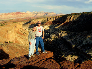
Overlooking the Goosenecks in the National Park.


From Sunset Point.


Still near sunset.  The Capitol geological feature
is above Judy.